Thursday, July 25, 2013

Trail Review: Ingalls Creek Trail - Part 2

Continued from Trail Review: Ingalls Creek Trail - Part 1

Suckers.

Nothing happened. The only injuries I sustained were the bug bites. Which, to be fair, I'm moderately allergic to, and they made my legs swell to the point of bruising, and that is definitely a new experience for me.

Here's a picture of my legs at the end of Day 4 (they actually continued to get worse until the following night).

Those rings around my ankles are not dirt, they are just swollen bug bite rings! As of today (4.5 days later) they are all bruised and awful. They don't itch anymore but it looks like I have lesions on my legs. Not. Nice. Anyway, back to the story...

Up until this point in the hike I would give Ingalls creek maybe an 8 out of 10 on picturesqueness. It was okay, but nothing particularly special. The sub-subalpine meadow where we set up camp at the end of day 2 was definitely pretty, but only enough to make it an 8 instead of a 7.

We decided to tidy up our camp, and have me just carry one backpack with as little as possible in it, and then on the way down stop at our campsite, have some lunch and rest up a bit before starting back down in earnest. This was absolutely the right decision and I would absolutely recommend doing that rather than trying to pack all your gear up and down.

First view of Day 3
So we started up towards Stuart Pass and the lake and it got increasingly gorgeous. The light on the mountains was stunning and it really showed off the depth and cragginess of the area. We hit this gorgeous meadow, and had to stop for quite a while. I really wanted to spend some time taking photos, but more than anything Chris had continued to feel bad, and it really came to a head on day 3, he actually puked a little ways up the trail and was feeling pretty bad, both physically and just in terms of morale.

We didn't end up going to the lake proper, half because we had a dog, dogs are not allowed at the lake so we would have had to go to it in shifts, and we honestly couldn't find it. There was really no signage directing us toward the lake, and the only trail aside from the one that lead up to Stuart pass seemed to peter out in the middle of the field. So we decided to take the trail that headed toward Stuart Pass to see if we could find the lake, or at least see it from the top. I think we probably would have been more inclined to do a bit more searching if Chris hadn't been feeling so bad and I hadn't been concerned about how long it was going to take us to get out.

Panoramic of the south end of the meadow

We never did find the lake, which I'm still a little bummed about.

Ingalls Peak
I won't be very sad about it because seriously that meadow was bananas! I wish I could spend the rest of my life there... If it wouldn't be illegal, and a complete bitch to get supplies to. I could swear I took pictures of Mt. Stuart, but I can't seem to find them, I thought Mt. Ingalls was more striking anyway, but it still would be nice to have them.

About half way up Stuart Pass, Chris looked at me and I could tell he was just done. He asked if we could turn around. I really wanted to see how much farther it was to the top so I left him in some shade and we each set a timer for 30 minutes. After 30 minutes more walking I was going to turn around and come back to him, no matter where I was, and if I wasn't back in 1 hour Chris would come find me. I took the dog with me, so that if I got hurt I could send him back to Chris.

Now, I would normally not ever, EVER, recommend doing this. It's not good to split up (think of every horror movie you ever saw). As it is, I have some reservations about Chris and I hiking just the two of us. If something happened to Chris I would have a very difficult time getting him out, regardless of the terrain, but I really didn't want our trip not to have an end.

That's Glacier Peak (we think)
Endings are wonderful things, especially when it comes to hiking. It completely boosts your morale,  and makes the trip back better, there are 3 ways it does this: 1) You typically get to see something beautiful 2) You have a sense of accomplishment, which is simple enough in concept but I can't overstate how important it is and 3) you know that from now on it is, quite literally (most of the time), all down hill.

I hiked for about 10 minutes and I was at the top. I took some pictures, and some deep breaths, turned around and went back down to Chris to try and get him up to the top. Which I did, and he felt better for it. I've very glad I did because these pictures (left, bottom) were definitely worth the slight risk. I think it definitely improved the rest of the day for Chris as well, which was good, because all told on day three we ended up hiking about 12 miles. It was especially difficult getting started again after striking camp.


One pooped pooch!
The rest of the trip out was uneventful. We were able to do the whole thing in about 72 hours total. I would (and very well might) absolutely do this again, and encourage anybody. I think it's a great multi-night trip. You could try and do it in 3 days and 2 nights, but I wouldn't recommend it unless you are in good condition and don't let bugs and overgrowth discourage you.

Multi-Night Menu and Mushroom Stories

Not that kind of mushroom...

Backpacking food is always tricky. I wish I was a little bit more adept at foraging just so I didn't have to carry a bunch of crap with me. Luckily I'm not stupid. Relying on foraging is not only a TERRIBLE idea, because there's no guarantee you will find anything, but it's not very environmentally conscientious to tear through an area and pick everything in sight. Ruins it for everybody else. Plus there's that slim chance you'll mix up Queen Anne's Lace with hemlock or something. Not good.

Even if you're thinking to yourself "Allison, don't be ridiculous I've been picking and eating wild stuff my whole life, that wouldn't happen to me." Well imaginary conversationalist, let me tell you something. Where I'm from in California there is a mushroom (amanita calyptroderma) commonly known as a "creamy top" or coccora that is (supposedly) very tasty. They are very close in appearance to another variety from Italy called Caesar's amanita which is also edible. So far everything is great, people from Europe and people who are fairly familiar with California fungi see it and think "Mmmm, tasty!" 

Here's where the trouble starts. There are two other types of mushrooms that are almost, almost identical to the creamy top (Amanita phalloides anAmanita ocreata). One of which is known, rather fondly, as the Death Cap (Amanita phalloides). Every 3 or 4 years some mycologist (person who studies mushrooms) would come out, and pick a creamy top and kill himself and his whole family. My point here is that relying on foraging is not smart for a bunch of reasons, but the foremost in my mind is, that even experts can make mistakes, and it's much better to eat a cliff bar if you're not 100% certain about something. Even if cliff bars are almost certainly flavored tree bark that's been masticated and regurgitated by a herd of camels.
Yeah, that's totally how they are made.

That tangential ramble brings me back to food for overnights. I won't discuss ultralight food because despite my dislike of carrying food, I am not at the point where I am willing to only eat dehydrated food.

For our overnight trip to Ingalls Creek this past weekend we are brought the following:

Breakfast: Instant cream of wheat, individual shelf stable creamers, raw sugar and instant hot apple cider
Snacks/Lunch: Almonds and dried cherries (some of which will be going in that cream of wheat), Cliff (Mojo) Bars
Dinner: Boil in a bag rice, instant Indian food from Trader Joe's, and vacuum packed chicken/tuna, freeze dried soup

You'll notice we only snack during lunch, we really don't like to stop and have lunch. It's one thing to snack on short breaks, but I don't like chilling for too long, otherwise I have a hard time getting started again. I feel like most people I know are similar in this way, 

If you want to read more about Coccora click here!


Trail Review: Ingalls Creek Trail - Part 1

Ingalls Creek Trail - July 19-22nd
Lower Ingalls Creek
32 miles
4,544ft of elevation gain, highest point 6,500ft
East of Snoqualmie Pass; I-90 Corridor
Dog Friendly (except for Ingalls Lake)
Difficulty: Intermediate
Someday I am going to learn to carry a topo map, and I think if nothing else this trip will be the catalyst for me actually doing that. I'll get to that though...

So congratulations to me, this was my first multi-night backpacking trip and it was AWESOME.

The original plan was to go to Image Lake, however there was some concern about snow on the trail and the road being out 11 miles before the trailhead and we just did not want to have to deal with it. I realize that dilemma could have been solved by a simple call to the correct ranger station, but Chris and I hate the phone, so we went with a simpler back up plan. Ingalls Creek to Lake Ingalls and Stuart Pass.


Our first view of the mountains, wait a second is that.....
Ermahgerd, it's Mt. Doom!!!


We started out on the trail about midday which was a mistake. I think Chris and I have become totally spoiled by always hiking on the west side of the Cascades because no matter what time of year it is it really rarely gets hot. Ingalls Creek trail is on the Eastside and it might as well be a completely different state. It actually reminded me a lot of the Sierra Nevada: dry and scrubby with a lot of pine and fir trees. We had to stop fairly often to get water and cool off. We ended up stopping about 6.5 miles in at Falls Creek Campground.

This campground was wonderful for the first night because it was really well protected from light and heat exposure, which was really great since you never sleep too well the first night and it let us sleep in a little.

Day two was pretty rough, there had been a forest fire fairly recently so the next 4 miles were almost totally exposed and the brush started to get REALLY bad. Not far into the hike we had been warned by a couple we met that they had actually planned on going farther but turned around because the trail was so overgrown.

I don't know what it is about hiking that makes me think that everybody around me is a total wimp, but it does. Every time somebody warns me about trail conditions I just think to myself, well they're obviously big babies. To some extent I think I'm right, I mean, if I drive two hours to do some hiking, I'm going to do it. Unless it is actually impossible, not even dangerous, but IMPOSSIBLE, I will try. This was no different. When the couple we met told us about the overgrowth, I thought to myself, it's can't be THAT bad, besides I grew up in the woods, I'm used to trail blazing. Which is all true, what I forgot it how completely exhausting trailblazing and even walking on overgrown trails can be. Not to mention painful.

Here is how thick the brush was, I am in both of the pictures below, standing on the trail:


In the one on the right I simply just lifted the brush out of the way.... Yeah, pretty damn thick.


Between the brush, the heat, and Chris feeling kinda poorly we probably only did another 6-7 miles on day two. This was starting to get me worried, it meant that between days 3 and 4 we were going to have to do at least 18 miles, which would normally be completely fine, but I was definitely concerned about our pacing, especially since day 3 would also include some elevation gain.


We camped on the edge of this beautiful meadow with a bunch of pretty gorgeous views (up-right, left, bottom right) and had a spectacular view from our tent (Up-Left). Aside from our first view of the mountains while we were walking through the fire section, we had been in lowland and there hadn't really been much to see. So it was wonderful to get out in the meadows and sub-subalpine areas. There were also tons of wild flowers and blooming fire-weed that was out all over the place during day 2.

The only other remarkable thing about day 2 was that the bugs came out in force. I had brought bug spray with me, but these biting flies we're like "DEET? What do you think we are? PUSSIES?! NOMNOMNOMNOM."

I went to sleep and during the night I had this dream: I got badly hurt, to the point that Chris couldn't stretcher me out. He would have to leave me to get help, I kept telling him to go slow and not rush, so that he wouldn't hurt himself in the process. As soon as I finished telling him he sprinted away.

I didn't know then how prophetic that dream would be...

Link to Part 2!


Sunday, July 14, 2013

Deepwoods Damnation

I am exhausted. I didn't sleep last night till 3:30am, which for me (and probably most people) is ridiculously late. Why am I exhausted you ask?

Because I was rocking the fuck out.

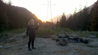
Last night was Deep Woods Damnation. My friend Marietta decided that for her birthday she was going to rent a couple generators and her band Audrey Horne (no website sorry) was going to play in the middle of the woods. She also got two other bands to come out (Don Peyote and Sioux City Pete &The Beggars). We drove out into the National Forest just East of North Bend and out a public access road. We helped unload band gear, set up our tent and then began the hard task of drinking.


I decided not to bring my good camera because I really didn't want anything to happen to it. There were going to be lots of people I didn't know not to mention the very real possibility of drunken negligence. I think it was the right choice but I am incredibly bummed that I don't have decent pictures. The pictures I do have do not do it justice. The colors in the sunset were incredible, the mountains were gorgeous but I just really wish I could have taken some shots of the bands playing. If there are some photos that appear later via facebook I will add them.

However! I did manage to get a video of Audrey Horne playing. Watch it! they are awesome and my phone actually did a pretty decent job.


The sound must have carried for miles. I have no doubt that there were other campers in the area and that they were absolutely furious with us. I certainly would be. However, I'm willing to take that in exchange for the memories from last night, though they got increasingly hazy. There are moments in everybody's life where you know that you are going to remember it forever. Most people think that about lots of things and don't necessarily remember them, but you know when you truly will remember because you feel it. You feel that moment burning into you, rattling your bones like a bass guitar.

I won't remember the names of the people I met. That Chris and I laughed about how metal trash and constellations are. Or how I rambled on and on to this poor girl about how I really want to make a sweet risotto with almond milk and coconut water. But I will remember the way the light illuminated the band, and the way the sound seemed to be a living thing tearing it's way across the mountains.

I am physically drained, but I don't give a shit. My life is fucking incredible.


Tuesday, July 9, 2013

Trail Review: Gold Creek Valley

Gold Creek Valley - July 7th
8 miles (+ 1.5-2 miles round trip of dirt road)
Negligable
Snoqualmie Pass; I-90 Corridor
Dog Friendly
Difficulty: Very Easy


A little over a year ago Chris, Katie and I tried to hike Gold Creek Valley. We were looking for a good early season hike and it had been recommended. I can’t remember who or what recommended it. It was probably something along the lines of “This hike opens in May” and we thought to ourselves sweet! It’s May 18th (guessing) it’s got to be melted out! We totally don’t need to look at trip reports o WTA or anything...

We drove out there and didn’t even get to the actual trail before things turned slushy. Apparently you used to be able to drive up to the trailhead, now you need to park at Gold Creek Pond and walk about ¾ of a mile to the trailhead. Not a big deal, and the only reason I bring it up is this: there were people getting ready to go cross country skiing on our way from the pond to the trailhead. That should give you a pretty good idea of how snow it was.

I hear you thinking, surely they turned back, they’re not total morons who would try to hike an unfamiliar trail in two feet of snow when one of them was only wearing tennis shoes and jeans. Oh how wrong you are imaginary conversationalist. We are absolutely that dumb. My guess is we went about 2 miles, maybe a little bit less. We lost the trail a couple of times, but what finally made us turn around was we all fell into tree wells up to our hips.

This time was waaaaay better.

There was no snow. It was warm but not outright hot, the trail wasn’t crowded or muddy or anything! It was pretty much perfect. It’s an incredibly easy hike. We ended up turning around where you need to ford Gold Creek to continue on to Mt. Alaska, we’d read reports that things got a bit overgrown and nasty after that and we were looking for an easy recovery hike because of how hard we’d pushed on the the 4th. Not to mention that Chris’ ankle was only just starting to feel better.

It was a gorgeous day. There were tons of wildflowers, including my personal favorite (aside from daffodils or narcissus but they're not indigenous): wild tiger lillies (right). About ¾ of the way through the hike it opened up into the valley where there had obviously been an avalanche or mudslide or something. I find that kind of destruction oddly beautiful. It was one of the most enjoyable, mellow hikes I’ve had so far this season, I highly recommend it if you’re in need of an easy day. Start earlyish though (we started about 10:30), on our way back we passed twice the amount of people going out towards the trail than we’d seen on it all day.

WTA Link for Gold Creek Pond (no entry for the trail itself)

Trail Review: Annette Lake and Trail Etiquette

Annette Lake - June 23rd
7.5 miles
1400 ft Elevation gain
Alpine Lakes Wilderness; I-90 Corridor
Dog Friendly
Difficulty: Easy

God I hate people. You do too? Thought so. I hate people all the time. Person’s, individuals are okay, I like them just fine. The more individuals there are though, the more unhappy I become

For the most part hiking mellows me out, but I think it actually increases my general misanthropy. I get on the trail and if it’s at all crowded I start to get really irritable. I think I just subconsciously pick a group of people to bitch about in my head. The more crowded it is, the more internal bitching.


When Katie and I (Chris’ ankle was hurt) hiked Annette Lake it was one of those wonderful summer days in the Pacific Northwest. Which meant of course, that everybody and their mother was out doing stuff in the nice weather, and apparently we all had the same idea to hike the same trail. We had two dogs with us this time since Katie was dog sitting. His name is Tucker and he’s AMAZING.


The trail itself is pretty easy, or it would have been if it wasn’t so hot. When I say hot I mean 86 degrees with mild-moderate humidity. Judge me as you like I’m pale and there’s a very good reason I moved to the Northwest. The sun and I are frenemies.

The group of people who I decided to berate internally on this particular day was a family of four. Here are the reasons why I chose them:

1. Even though we were hiking faster than them, we took a few breaks to water the dogs during which they would pass us. Afterward we’d catch up to them and as soon as they saw us they would leap up from where they were resting and go. Which meant I had to stare at their backs until we were finally able to pass them. Which brings me nicely to number 2.


2. THEY WALKED SIDE BY SIDE ON A FAIRLY NARROW CROWDED TRAIL. I apologize for the caps, but I can’t begin to express how much this irritates me. I won’t even try. If you do this. Stop. Just stop.

3. The daughter was wearing jean shorts (separate issue) and every time I passed her she had this look on her face like “I totes hate being in nature, especially with my parents! GAWD.” Now, I understand, because her parents are stupid, but I don’t want to see anybody on a trail, especially stupid teenager faces. 

There was one other person who irritated me.
We stopped to let this old couple come down a rocky section they had started, even though we had the right of way. While we were stopped this guy walked around us and plowed right through old people. Who the hell does that?!

Anyway aside from all the stupid people the hike was really nice. There were some really beautiful views of the mountains on the way up. The lake itself was gorgeous, and I got to play in it with a really big puppy.

WTA Link

Note: A few of these photos were taken by Katie, not me.

Monday, July 8, 2013

Trail Review: Pratt Lake and Temporal Shenanigans

Pratt Lake - June 23rd
8 miles
2300 ft Elevation gain
Alpine Lakes Wilderness; I-90 Corridor
Dog Friendly
Difficulty: Moderate

Hikers beware! Pratt Lake has a temporal distortion on the trail! Wait, I’m getting a little ahead of myself, let me go back...

You start your hike up to Pratt Lake, in the same way as most hikes in the Alpine lakes wilderness. It’s a nice walk through an Evergreen forest with a mild-moderate incline. The highlight of the hike for me was the view from a ridge above Talapus Lake. I think if it had been a bit clearer we would have been able to see Rainier very prettily situated.


You continue up, there are some super cute bridges that you cross over, and if you did the hike early in the season (like we did) you’ll be walking through some snow. There was some crazy mist that was hanging out over the snow that I’m a little sad I did not take pictures of.

Till now everything proceeds as it ought to. Time does nothing out of the ordinary and you are just happy hikers!

You hit the saddle and start descending into Pratt Lake basin, we had to do some scary-ish skirting over snow/ice fields on an incline (not recommended without ice axes, we’re just idiots). Pass over some rocky/boulder fields. You walk through a little bit of forrest and you’re at the lake.

And it takes a fucking year to do all that. No really, it looks like a long descent and it is. Until you start to go back up.

The lake itself is pretty ho-hum (so ho-hum our whole group forgot to take pictures), or at least it was for us on this particular day. I think if it had not been so very cloudy and overcast that would not have been the case since I’ve seen pictures of the lake on sunny days, and the color and clarity of the water look pretty stunning.

Then you start ascending up out of the basin and it takes like 15-20 minutes. What in the holy hell is going on here? It took us an hour to go down and 20 minutes to go up. While the terrain was not the smoothest, I have never in my life had this happen. I have some knee issues so I’m a little slow going down but it never takes less time.

The only conclusion I can come up with is that there is a temporal distortion. If this happens to you, keep calm, call the Doctor.

Trail Review: Boulder River

Boulder River - May 27th
8 Miles
500ft Elevation Gain
North Cascades (near Darrington)
Good for Dogs
NW Forest Pass
Rating: Easy

Our hike on Boulder River started off pretty dramatically and ended... nicely, though it was a bit anticlimactic. Chris was ill so I ended up hiking with our friend Katie. The drive to the trailhead was quite lovely. I always love driving out to the North Cascades, I think they are the pretties mountains I've ever seen. People always gush about the peninsula. Feh. Give me the North Cascades any day of the week. See (below)? That's just barely getting towards them, they get so much better!

However, when we got to the trail head there were at least 10 Search and Rescue vehicles. The drive isn’t a short one from Seattle (about 1 hour 15 minutes), so we were super worried that we wouldn’t be able to hike.

As we got closer to the trail a woman informed us to please make sure we yielded to search and rescue, since they should be on their way back and carrying equipment. She then walked over to their FOOD TRUCK to get a breakfast burrito.

I will let that sink in. 

Search and Rescue has a food truck. With breakfast burritos! This sparked an entire conversation between Katie and I about how we would love to join Search and Rescue, except we don’t have climbing skills, helicopter piloting experience, or a desire to possibly have to get out of bed before 7am. We concluded we could not join Search and Rescue, but that breakfast burritos are delicious.

After that things were pretty much routine. We ran into aforementioned Search and Rescue personnel and they informed us they’d been out since 2am helping some stranded hikers. Further proof that Katie and I could not get breakfast burritos.

The hike was nice. There are a couple of nice waterfalls along the way and you never stray too far from the river itself, which I also find keeps me relaxed. I will say the trail conditions were not ideal, the trail was VERY muddy. Not “oh dear I might get some mud on my boots muddy,” more like Never Ending Story “ARRRTEX!!!” muddy. The grade is fairly level and we didn't need to take breaks at all going in or coming out. Though there was some route planning involved on how to avoid the majority of the mud.

The hike itself ends sort of weirdly. There’s no real conclusion, no this-is-the-place moment. It just sort of stops and you get to sit by the river have some snacks and turn around a slog it back. If you’re lucky there will be some crazy ass mist that is just hanging out over the river though. Which is pretty cool.


Trail Review: Baker Lake


Baker Lake East Bank - May 18th
14 miles ONE WAY
500ft Elevation Gain
Mt. Baker Snoqualmie National Forest
Good for Dogs
NW Forest Pass 
Rating: Very Easy (except for distance)


Oh Baker Lake. You had me so goddamned confused.

This hike is a perfect example of why it is important to carry topo maps with scales on them. I had just neglected to get one, because in order to get the entirety of Baker Lake from USGS topo maps I would have needed to download and stitch together 3 different maps. I was feeling lazy and just decided not to. Obviously a poor choice.

On WTA’s site there are two hikes listed for Baker Lake, the hike to Maple Grove and “East Bank” which supposedly terminates at Noisy Creek Campground. Maple grove is 8 miles round trip, and the East Bank is 9. It looked like each of the WTA’s hikes started out at a different trail head, Maple Grove at the southern trail head and East Bank at the north. I figured we could at the very least do one hike one day and the next day do the second. Then my hiking book says that Baker Lake East Bank is 14 miles. I assumed there was just some wonkiness going on with the mileage, especially since Noisy Creek Campground is on the northwest bank. I just figured WTA had a seizure when writing that post.

Now normally my hiking book lists hikes with round trip mileage, very seldom does it list mileage one way. I had looked at both posts on WTA, and just skimmed the entry in my book, and didn’t think it was necessary to carry the book with me. Well, you can see where this is headed.

The east bank of Baker Lake is 14 miles one way. We got 7 miles before we started to get a bit suspicious. However, as previously stated, we’re a bit stubborn. We decided we’d go a bit farther. We went about 10 miles total and came to an important conclusion. We were 4 miles from the North end of the lake, but were not completely sure where there would be a campground, and if we did go all the way, we would have to hike 14 miles back the next day. We decided it was a little too early in the season to be thinking about 28 miles in two days and turned around, hiking 5 miles back to Maple Grove campground. I can tell you, 15 miles with an overnight pack is about my limit.

Aside from our issues with not reading this properly and a lack of maps. It was a very lovely day. Cool and cloudy for most of the day, which was nice it actually made the lake look a bit mysterious. Then it started to open up in the late afternoon and evening (top two pictures). I seriously wish we had remembered to take photos of the sun going down over the west bank. It was really gorgeous, we sat on a log jutting into the lake and watched it go down. Not to mention the huge quantities of wildflowers that were everywhere.

We made camp near the lake, in an established site. There were some other people around us but it wasn't terribly crowded, thanks probably to the weather. I fell asleep really early and the next day we had my favorite backpacking breakfast: instant cream of wheat with dried cherries and almonds. We dragged our poor tired butts the 5 miles back to the car in the morning. On the whole I would say this was a pretty good hike, would be great for beginners, as long as they weren't planning on doing the full East Bank. If you had two vehicles it might be a pretty nice key swap or shuttle option.

Trail Review Greenwater and Echo Lakes

Greenwater and Echo Lakes May 4th and 5th
14 miles (including Echo Lake)
1600ft Elevation Gain
Mt. Baker Snoqualmie National Forest, near Enumclaw
Good for Dogs
NW Forest Pass 
Rating: Easy


We did this hike back on May 4th and 5th, but then got really busy with my birthday and a bunch of other stuff and I got distracted. Chris, our friend Katie and myself left Seattle around 8:45 and drove out the Greenwater Lake trail head. This was our first real overnight of the season, and unfortunately Chris and been having really bad acid reflux, so we were moving pretty slow. The hike out was lovely, it was warm but not hot, and while there were quite a few people on the trail it didn’t ever feel crowded.

We got to the end of the second of the two Greenwater Lakes, and a man with a struggling campfire told us he had tried to get to Echo lake and had been unable to go the entire way due to snow. Being the stubborn, independent types we are we decided we needed to see it for ourselves. After all, this man had a tea-cup sized dog, so obviously he was insane, not to mention he had shorts on so maybe the “snow” was just slush that was 100 yards long and we’d be able to cross it easily.

We could not.

We went another 1.5 miles before we hit the snow. It started out manageable enough, the trail was easily spotted, but after about ¾ of a mile of increasingly deep, often slushy snow, we were done and decided to turn around.

Luckily just after we had passed the guy who said there was snow ahead Chris spotted a campsite that he said looked amazing. I couldn’t see it through the brush, but after we turned back we decided to head for that spot. The campsite ended up being on an island where two forks of the greenwater river converged and dumped into the lake. We had to scramble across some fallen trees, but oh man. BEST. CAMPSITE. EVER.


We spent the night drinking wine we had packed in, and playing camp Disney trivia (that’s where we bring some Disney trivia cards but not the whole board game). Then as we went to bed we listened to an audio book of Scary Stories to Tell in the Dark and recordings of Vincent Price and Basil Rathbone reading selections from Edgar Allen Poe. In all a pretty awesome evening. The rest of the trip was pretty uneventful.

WTA Link: http://www.wta.org/go-hiking/hikes/greenwater-lakes


Friday, May 24, 2013

Edible and Medicinal Plants Book Review: Part 3 of 3

Title: Medicinal Plants of North America (A Falcon Guide)
Author: Jim Meuninck
Illustrator/Photographer: Not Listed

So this is officially the best of the three different edible plant books I’ve reviewed. It’s funny, I didn’t purposely review them in order, but it ended up being that way. I couldn’t find a single thing I didn’t like about this book. The only downsides are that it’s heavier than the other two, and not as region specific, but that is good news for any readers who don’t live in the Pacific Northwest.

Here are all the pro’s, and there are a bunch:

The structure of the book itself is really well done. It is nicely divided by region and type of area, eastern forest, wetlands, meadows etc. Each individual plant entry includes well organized sub sections including traditional and modern medicinal uses, recipes, gardening tips, precautions and information about toxicity, wildlife and veterinary issues and uses. Semi-gloss means semi-water resistant.

Even though the book is primarily for medicinal purposes it has a lot of information about which plants are edible and ways to prepare them. As far as the medicinal uses go it also discusses how to prepare different remedies, including recipes but also descriptions of how to make tinctures, poultices, decoctions etc. It has really excellent photos, and provided photos of poisonous counterparts alongside the correct one, increasing the probability of correct identification. I also straight up love the information on wildlife and veterinary uses! Yes, I totally want to know what plant I can use to suture my dog! Unfortunately I forgot to write it down so I’ll have to wait till I actually purchase the book instead of borrowing it so I can look through and bookmark the page.

$9.49+ Via Amazon

Tuesday, May 14, 2013

End of Hiatus and Brief Update.

Hey all, sorry about the temporary hiatus. Chris and I have been super busy these past few weeks and till last weekend hadn't been hiking because there was other stuff that needed to get done. However, we are planning on getting back to it in earnest in the next few weeks. Chris also planning on doing some contributions himself, we're not sure whether he'll just do some guess authorship or if he's going to post on a more regular basis.

Upcoming posts:
Part 3/3 of my Medicinal and Edible Plants Book Reviews
Trail Review for Greenwater Lakes
Trail Review for Baker Lake (and possibly part of Baker River)
2 Part Dog Gear Review Series

Tuesday, April 16, 2013

4 Things Beginning Backpackers Should Know About

I mentioned briefly in my last post that my backpacking trip for this past weekend got cancelled. Which is a big bummer because I had a bunch of posts that were contingent on that trip. There was going to be a food for backpacking post, Primitive Fire Part 1: The Bow Drill, and obviously a Trail Review, since that's not happening now I had to make something up on the fly.

That something is going to be 4 Things/Products you should  know about or have for backpacking.

1. REI's return department.
I had no idea this existed until a few years ago, and it's pretty much amazing. Basically because REI has such an amazing return policy they end up having to re-sell a lot of items. Some are not perfect but if you take some time you can almost always find something great. In Seattle's big REI store it's behind the Bicycle area downstairs. Some fun examples of stuff I've got there: REI Half Dome 2 (MSRP $189.00) for $20. The only thing wrong with it is a small hole in the mesh about the size of a pencil eraser. A Marmot 30 degree sleeping bag (MSRP $99-$109) in my favorite color (Chartreuse, not easy to find!) for 17.50, no problems the original buyer didn't like the color!

2. Dr. Bronner's Liquid Soap (4 oz - $4.25 @ REI)
Backpacking it's always good to have things with multiple uses, it saves weight and just generally makes your life easier. Dr. Bronner's is pretty much the ultimate soap. It's good for face, body, shampoo, toothpaste, some people on extended trips use it for laundry detergent. It's pretty much awesome, as well as being pH balanced, sulfate free, organic and biodegradable.

3. Jack Black SPF 25 Lip Balm- Assorted Flavors
(There's a full review of these on my beauty blog The Dead Don't Lie)
I have a thing about my lips. If they are at all chapped at all I will pick at them till I bleed. I have really fair skin and large lips, and they get dried out and burnt pretty easily. For this reason I always carry lip balm that has SPF, if I'm going to be out in the sun, the wind, and alpine areas with less moisture I need help. My favorites are Honey and Shea Butter and Grapefruit and Ginger

4. Swiftwick Socks (Website here)
Have you ever put on a sock, gasped audibly and then exclaimed: "Holy Shit Ballz! This is the greatest sock ever?" No? Well I have, and slipper socks DON'T COUNT. Swiftwick socks are seriously incredible. Chris and I each have a couple of pairs and we love them. I'll do a full review at a later date. But if you do any kind of activity you should get these. They come in varying price, length and thickness. The Vibe line are my favorites, they are the most amazing compression socks ever. EVER.

Friday, April 12, 2013

Backpacking Gear List

I love packing for overnights. They’re less stressful when it comes to packing because you don’t have to agonize over every ounce and cubic centimeter of space. This list is pretty exhaustive, I’ve divided up the list by what each individual should have and then things like sunscreen etc. that only one person needs to carry. That being said I would almost always recommend that for every 2-3 people you have secondaries of these items. There are some items that it’s good to have different people carrying. For instance when Chris and I hike one person carries the water filter and one person carries the first aid kit which has iodine tablets. That way if we lose a pack we have a way to sanitize water. Other things we typically split up are fire-starting equipment and food, which can be a pain on multi-days when we’re both unpacking to put stuff in a bear bag. However, I feel better knowing we won’t have all our eggs in one basket if something were to go wrong.

This list is a good starting point for multiday trips as well, you’ll just need to adjust the amount of food and spare clothes you’ll need. As long as we’re on the subject of clothes, and since I can’t think of a better place to mention this, let’s talk about when you’re sleeping. I have a 30 degree bag, which if you're a girl you know means you're not comfortable after about 38-40 degrees. So for early season hikes, or when I know I'm going to be somewhere that's going to be particularly chilly during the night I have to bring extra clothes to sleep in. For me this is sweats, a long sleeve cotton thermal, slipper socks and a sweater. I can shed a layer if I need to but I don't sleep if I'm cold.

My trip for this weekend got cancelled so I won't have pictures. The next time I'm packing for a trip I'll take some photos. Also as I continue to post gear reviews the items will link to examples.

Gear List
Sleeping bag and mat
Water Reservoir or at least 2 one QT bottles,
Multi-tool
Food
Clothes: I always bring 1 more pair of socks and underwear than I need
Mess Kit
small flashlight/headlamp (we also keep one in our tent as a backup)
Backpack cover or large garbage bag

Tent (make sure you have your poles, stakes, etc.) and footprint/tarp
3 kinds of fire (ferro rod, butane torch, lighter, matches in waterproof container, magnesium rod etc.)
50 ft of 300 lb test cord
First aid kit
Compass
Map (if needed)
Water filter and iodine tablets
Stove and fuel
Cooking pans
Toiletries (Small Hand Soap, Small Toothpaste, Toothbrush, Comb, Floss, small Fast-Drying Camp Towel)
Sunscreen/Bugspray
Bear Bag (we just hang an OR Stuff Sack from a tree)
Garbage bag

My dog carries all his own stuff except for his water. This is possible as long as long as your dog is big enough, they really don’t make packs for dogs under 25lbs, here’s a list for your buddy

Dog Gear:
Dog Backpack
Food (don’t forget to put in bear bag at night, even if there aren’t bears it’s good to seal this guy up in case of raccoon etc.)
Treats
Poop bags
Toys
Cloth travel bowl
Sweater (if needed) for when you stop

Wednesday, April 10, 2013

Therm-a-Rest RidgeRest SOlite Sleeping Pad

I hate inflatable sleeping pads. Unless you are willing to spend a lot of money on them they are cold and uncomfortable. I can’t help but thinking that expensive mats are going to be like expensive sunglasses. I’ll spend the money and promptly lose or scratch the damn things while my cheap ones last forever. I will also admit that despite years of dancing I’m klutzy when I walk. So I’m always worried that I’m going to put a hole in my mat. This fear is multiplied by the fact that my backpack is kind of narrow, because I’m small, so it doesn’t easily fit most mats along with the other gear that I have to stow on the inside so I tend to have to carry them on the outside of my pack.

So here I am stuck between the proverbial rock and a hard place. If I spend the money to actually buy a comfortable mat I’m going to pop it, and if I don’t I don’t get very good sleep, not to mention being sore and grumpy in the morning which is not exactly a great way to start your second/third/n+1 day of hiking (math jokes are awesome).

The Therm-a-Rest RidgeRest Sleeping pad is a pretty decent compromise. It’s quite durable since it’s a foam mat. I was skeptical about how effective the metallic finish would be at reflecting heat, but it works pretty well and I run cold in general. It’s also pretty light and I can carry it on the outside of my pack without fretting about every stray branch that hits it or every time I set my pack down.

It is not the plushest sleeping pad, I have to sleep on my back or my hips hurt from pressure on my bones. I also have a bit of a sway back, so sleeping on a flat surface on my back all night tends to lead to some lower back pain in the morning, which is usually walked off pretty quickly. It would take a fairly plush mat, either foam or inflatable to counteract that anyway though.
Overall it’s a pretty good product, especially since price-wise it’s very reasonable and I’m pretty happy with it. At some point I might invest in a thicker foam pad, especially for when weight is less of an issue, but for now it’s working just fine.

Specs
Packed size 8x20 inches
LxW 72x20/183x51cm
Thickness.62inches/1.5cm
Weight 14oz/0.4kg
$19.95-$39.95 (depending on size) via REI

Monday, April 8, 2013

Edible and Medicinal Plants Book Review: Part 2 of 3

Title: Northwest Foraging: The Classic Guide to Edible Plants of the Pacific Northwest

Author: Doug Benoiliel
Illustrator: Mark Orsen
Bottom Line: 4.5/5 stars

It’s sort of like all my complaints about Wild Harvest were addressed when this book was written. It’s pretty much awesome. One of my favorite things about this book is that Benoliel is really sort of goofy-nerd self aware, he makes some endearing deprecating comments about his sense of humor here and there and just in general is a very likable writer.


The book itself is fairly light probably only 0.5-1lb, which would make it pretty easy to carry on an overnight unless you were going ultra light. The pages are matte, so you would definitely want to transport in a waterproof bag.

As far as contents, there is a lot about this book that I really like. There’s a nice overview by season, that is further classified by type of plant and/or preparation (berries, seeds, raw greens, greens for cooking etc.), I will say I think this could be improved by having the corresponding page numbers but the book is alphabetical so this is not a huge problem at all.

There’s some interesting nutritional data for wild plants comparing them with grocery store fruits and veggies, based on USDA data, which is pretty cool. One of my biggest issues with Wild Harvest was the technical terms without appendices to illustrate what they meant, this book has that and goes a step further by giving some examples of plants that illustrate the terms. The illustrations themselves, both in the appendices and throughout the book, are really nice looking.

There is a really nice variety of plants and he groups similar items (mostly plants within the same genus) so there aren’t separate entries for different types of blueberry, but he does explain the differences within the entry. He touches on some of the medicinal properties of some plants. Also including historical and Native American usages, which is pretty nifty.There are very clear warnings for plants with inedible or poisonous look-a-likes, which was probably the biggest problem I had with wild harvest.

The only thing that I really missed in this book was photographs of the plants. While the illustration were quite good, I think that photographs are really important especially since the illustrations are black and white. A lot of how I initially locate plants, especially when I’m out walking is by colors, after that I use shape and size to confirm it’s the plant I want but color is how I find it. Even though the descriptions are accurate telling me the flower of a plant is pink is only so helpful.
However so far this is one of the best edible plant books I’ve seen. I have one more book here at home on edible plants (not including mushrooms to review), which is a bit heavier than this book, so unless that book is better, this may well end up being what I purchase for myself.

Thursday, April 4, 2013

Deception Pass State Park: Part 2


This post is going to go up a day early since tomorrow promises to be a bit hectic. 


I woke up after dozing off for a bit and thought to myself “Hmmmm there’s no dog in my sleeping bag. Where the hell is Jaxx?” He usually sleeps in my bag when it’s cold, because he’s spoiled and I don’t mind the extra warmth. I woke Chris up to make sure he wasn’t with him. Turned out he’d nosed his way out of Chris’ door. Shit. Shit. Shit.

If you’ve ever had a pet disappear, you know it sucks. It’s especially awful when you’re in an unfamiliar place and your dog has a particular affinity for cars. I ran out of the tent and started whistling from him. Got about 50 yards from camp and this woman came around a building and asked “Did you lose your dog? Is his name Jaxx?” Oh thank god. He had just wandered into a neighboring campsite where people were still up. My dog likes to party. Needless to say we’ll be investing in some small carabiners to seal the tent zippers at night. But everything was fine, although I didn’t sleep much the rest of the night, first because I was totally afraid that I was going to lose Jaxx again, second because by this time the tent was slowly beginning to collapse.

For me the tent wasn’t really a problem. I like small spaces and it wasn’t completely collapsed so I didn’t have tent material on my face. The nice thing about your tent collapsing is that it’s really toasty. It’s a general rule of thumb that the less space inside a shelter and the lower the ceiling the warmer it’s going to be, since warm air travels up. This goes for primitive shelters as well. However, Chris is a lot bigger than me and he had damp tent on his face. Not pleasant. He didn’t want to move to the car, so poor guy ended up rolling up his sleeping mat and using it to prop up the center of the tent. Around this time I finally passed out. 

Ko-Kwal-alwoot
Next day we struck camp pretty quick and went up to the north end of the park (Fidalgo Island) to do some additional hiking. It was warmer and even prettier out. On the way we stopped and took some pictures from the bridge (Above). We started out at Rosario Beach, which WTA had mentioned as a very pretty spot. My favorite part was this gorgeous carved Samish (Native Americans indigenous to the area) statue of Ko-Kwal-Alwoot, also known as The Maiden of Deception Pass, who ended up marrying the family that rules the sea. The carving is beautiful, but really I love the story, you can read it here.

Day two was short, we were both pretty exhausted from the previous day’s hike and the long night. Only hiked about miles total, but it was a beautiful day. The Olympic mountains were out in the west (click on the photo below to see them a bit more clearly). One thing that struck me (on both days), especially being from a coastal region myself, is how clear and empty the water is here. I’m used to surging surf, tons of kelp and sea life. In the area I grew up in California the water and sea life is pretty similar to what you find in Washington marine areas, tide pools and rocks seem to be alive with all manner of sea urchins, crabs, starfish, different types of sea plants. Here it was just empty which, while a little jarring for me, does make for some beautiful water. I could almost pretend I was in the Mediterranean.

Overall definitely go visit Whidbey, but I would recommend going during the week, or off season to avoid lots of groups. Unless you are one of those people who love car camping, because you're very social and inevitably make friends with everybody in neighboring sites. Good for you, you damn alien. 

WTA Link for our second hike here. It's also highlighted in red on the map of the park in Part 1.