Friday, March 27, 2015

PCT Planning - Food, Calories and Eating Like it's the Apocalypse

An example of food for a 3 day backpacking trip
Most of my family's questions about our plan to hike for three months have been centered on food. It makes sense; my mother, sister and brother are or have worked as professional chefs, I at one time wrote a food blog and the whole family certainly loves eating.

The big concerns on the PCT when it comes to eating are these: Eating enough. Eating enough. Eating enough. Eating enough...different stuff that you don't want to claw your eyeballs out when you see oatmeal for the literally the 100th time. And of course getting the nutrients you need.

Small people hiking upwards of 10 miles a day are going to be burning around 3000 calories, large people will be burning closer to 6,000. There are fluctuations with this depending on pack weight, how strenuous the hike is, etc. This means a lot of food. If there were fast food restaurants dotted along the PCT there wouldn't be any worries, but there aren't, so you end up battling a consistent, ravenous hunger that doesn't stop.

The trick here is carrying enough food to meet your caloric needs without weighing yourself down.

Fresh food is a luxury you can only have when you go into town. Canned food is preposterously heavy and often doesn't have much in the way of calorie pay off. Find yourself a store with a good bulk foods section. Folks in Eastern Washington, Nevada and Idaho should absolutely check out WinCo. I could almost write songs about their bulk foods. All the nuts, dried fruit, dried soups, oatmeal, etc. a hiker could want.

After that it's really about making sure you have variety and calories. Chris and I are like most hikers in that between breakfast and dinner we mostly just snack on the trail. Maybe do some sort of tortilla wrap or energy bar, but certainly we don't stop to cook.

I'll do 3 additional posts with recipes for breakfast, lunch and dinner once their finalized (we're testing everything over the next couple weeks).

Friday, March 20, 2015

Training for the PCT

Sorry these haven't come up more frequently. This semester is kicking my ass. Between now and May Chris and I will be doing exclusively PCT planning posts, and then once May rolls around we'll back on hikes/trail reviews. They will NOT be PCT updates (though we'll try and do those as we hit WiFi areas) rather they'll be guest posts and backlogged hikes.

Let the madness begin!

There are two camps on training for long distance thru-hikes. The camp that trains and the camp that doesn't. The latter think that the trail will beat your ass into shape and anything you do before hand is not going to matter because the stuff that long distance hiking does to your body can't be replicated by training.

I personally find this explanation to be completely ridiculous. Sure firing a gun in combat is way different than being at a gun range, but you wouldn't want to be dropped into a combat zone not having fired a gun before. I think I've actually had that nightmare before...

Chris' Mom on one of our training hikes

So obviously, Chris and I decided that while training can't completely prepare us, some preparation is going to be better than none.

We've been getting up at godawful o'clock every morning (something I am less than thrilled to do) and walking for an hour with our packs on. We built training packs, which are basically our old backpacking packs (we'll switch to the new ones when we get them next week) loaded up with milk jugs full of water wrapped in blankets. I'm training with about 30 lbs of weight and Chris with about 35. This is about 5-10 lbs less than what we're going to be carrying on the hike.

At the Base of the "N"
We try to walk on uneven ground as much as possible since walking on asphalt doesn't allow for support muscle strengthening. We're lucky enough to have some nice opportunities for some elevation near by as well. We hike up to the above "N" in Reno (which means nothing to those of you outside the area). Every week we do a 4.5 mile hike with about 700 feet of elevation gain and once a month we're doing a 12-16 mile hike. In a few weeks we'll also do a practice run with full packs for approximately 30 miles over 2 nights.

Aside from the early mornings, I've actually been enjoying the daily exercise. I think it's definitely making me a little less crazy. Although I have to put up with Chris singing made up songs to me at a ridiculously early hour of the morning. Jaxx is also benefiting since one of our routes takes us through a dog park, so he is getting some extra ball time.

The views aren't much, but the pay off physically is great. When Chris and I recently visited and hiked around Arkansas (posts forthcoming) we felt like super heroes! Between the training and being significantly closer to sea level we basically ran up hills.

Monday, March 9, 2015

2nd Nevada Hike, Marlette Lake


Marlette Lake - August 8th, 2014
Lake Tahoe State Park - Incline Village, Nevada
Distance: 8.8 mi / 14.2 km (Round Trip)
Elevation Gain: 1,200 ft. / 426.7 m.
Highest Elevation: 9,400 ft. / 2865.1 m.
Dogs: Allowed
Difficulty: Moderate
Fee: $10.00/vehicle

We mentioned in the second to last post that our first experience hiking in the desert was kind of a mixed bag.  Also, it is pertinent to this post to mention that after a few weeks in the ugly valley part of the desert in which Reno and Sparks proper reside, Allison and I were both missing the lush environment that we had become accustomed to in the PNW. We both were having some misgivings, in that respect, about our decision to relocate to the freaking high desert.  Those feelings were happening up until the day we embarked on our first adventure to Lake Tahoe.  For those of you who have never gotten a chance to experience it in person, let me tell you that Lake Tahoe is an indescribable natural phenomena which is as immense as it is beautiful.  It was also our saving grace, keeping both of us from spiraling into a situational outdoorsman's depression.

Panoramic of Marlette Lake (click to enlarge)
Now I'd like to share a few interesting facts about Lake Tahoe.  #1. Lake Tahoe definitely has a huge sea monster living in its depths.  I know this because at maximum depth of 1,645 ft. it is the second deepest lake in the United States, and I also happen to know that any lake that large and deep has to come with a sea monster.  #2.  It is not only deep, but it is also huge, surface area wise, with a surface area just shy of 200 square miles.  #3.  It is high.  The lake itself sits at 6,225 ft above sea level and is surrounded by mountains that top out at 10,981 ft. above sea level.  All of these features combine to create a region where you can't look in any direction from anywhere even close to the lake without seeing an absolutely stunning view.  

Chris, Allison, Jan & Jaxxon
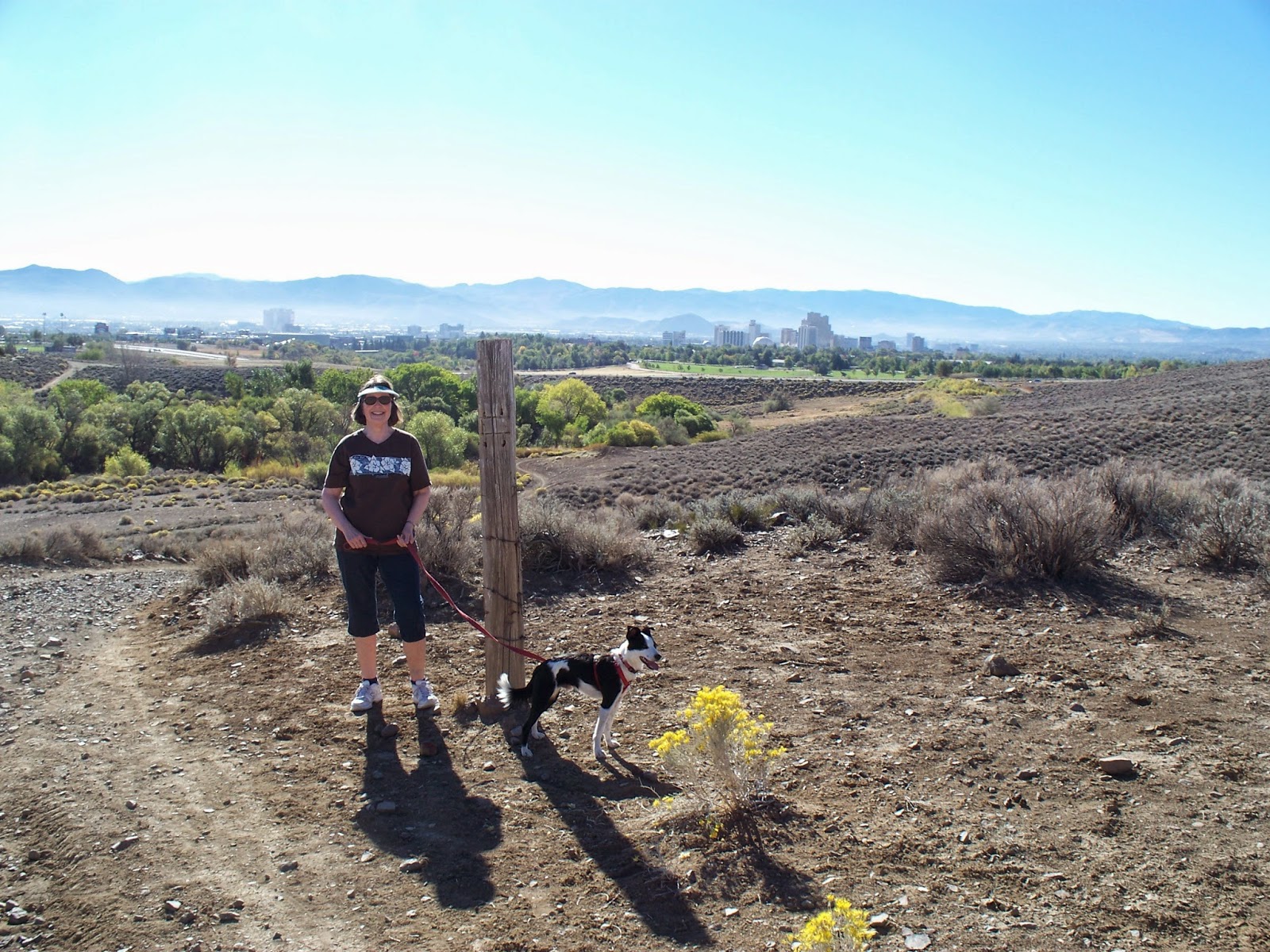
With that said, we were thrilled when our friend, Jan suggested that we take a short 45 minute field trip from her house in Sparks, NV up to Lake Tahoe St. Park to hike one of her favorite hikes in the area, Marlette Lake.  Now, while Marlette lake is a mere speck of a lake compared to Tahoe, it is also very very pretty.  

Being that the beginning of the Marlette Lake hike sits at a sizable 8,200 ft. of elevation with the hike's highest point being at ~9400 ft., and given the fact that the highest peak Allison and I summited in the PNW during the summer 2014 hiking season topped out at ~5000 ft. above sea level, we were both unsure of how our bodies were going to handle exertion at this elevation.  Luckily, as we had mentioned in the second to last post, we had been making a concerted effort to walk for 45-90 minutes almost everyday of the week to help get acclimated.  Honestly, I think that expenditure of time ended up really paying off.  Don't get me wrong, the Marlette Lake hike wasn't like strolling through Central Park drinking a latte, but even though we were both huffing and puffing during the 1,200 ft. of elevation gain, I can't imagine how much worse it would have been if we hadn't decided to do our training walks.

Here are the bikers I was talking about
The hike starts at one of the Lake Tahoe State Park's ranger stations right off of Highway 28.  There are several ways to get to Marlette lake, but we decided to leave the car in the parking lot of the rangers station and begin the hike from there.  The hike is out and back on the same trail, with the mid point of the trail being the lake itself.  The trail system in most of Lake Tahoe is shared between hikers, cyclists & horseback riders.  This combination can be somewhat infuriating, especially on particularly popular trails.  What it usually means if you are a hiker is you end up having to move off the trail multiple times throughout your hike to avoid getting in a collision with bikers who may or may not be following proper trail etiquette of alerting you of their presences vocally or with a bell and giving you the right of way.  While this was also the case with the Marlette Lake trail, it was also designed so that a little after the beginning of the trail, the path splits in two trails, one which is designated as hikers only.  This made for an overall much more pleasant hiking experience for the four of us.  

After being treated with beautiful terrestrial views through the first half of the hike, we arrived at the lake.  At this point in the day it was almost perfectly clear except for some brilliant white clouds in the sky.  This caused the water to be a brilliant blue which was especially cool when contrasted with the greens and reddish browns of the surrounding Sierra Nevada landscape.  Jan had packed us all of the fixings for some really upscale sandwiches.  After about ten minutes of meticulously constructing mine, I fumbled and I dropped my sandwich which exploded as it hit the ground, covering all of these awesome ingredients with a fine, inedible layer of tiny pebbles.  Needless to say, this was one of the most heartbreaking, earth shattering experiences I have ever suffered during a hike.  Luckily, I was able to salvage some of the materials and augment what was left with some leftover fixings the rest of the group didn't want.  Jaxxon also didn't mind eating a few little rocks and some dirt and ended up getting a nice little snack himself.

The day was so nice and the water was warm enough, so Allison decided to take a dip.  It was pretty neat to be at a lake that high up and be able to spend any amount of time in it comfortably.  That would never happen in Washington!  After her dip we explored the bank of the lake a little further and then began the journey back.  By the time we turned to head home, it had started sprinkling.  About half of the way back to the car we started hearing thunder in the distance which continued and became more frequent for the duration of the hike.  This was pretty much okay for everyone except Jaxxon who, believe it or not, is deathly afraid of thunder.  So, every time there was a thunder clap, Jaxxon would explode with barks and growls.  Needless to say, this situation, which happened every 200 or so feet for the rest of the hike wasn't really so nice for the rest of us.  Luckily we got to the car and avoided any real precipitation.

Overall it was a really great hike and really deeply influenced our feelings towards our new home in a really positive way.  We have since grown to really like even the uglier parts of our new climate and hiking region and we also continue to be pleasantly surprised by the stunning places we continue to find as we further explore the region. 

Monday, March 2, 2015

Goat Lake


Goat Lake - February 21st, 2015
North Cascades - Mountain Loop Highway
Distance: 10.4 mi / 16.8 km (Round Trip)
Elevation Gain: 1400 ft. / 426.7 m.
Highest Elevation: 3161 ft. / 963.4m.
Dogs: Allowed
Difficulty: Easy
Required Pass: Northwest Forest Pass

About the Author:
My name is Katie Young. I am a veterinary technician in Seattle, WA. When I'm not fixing sick puppies and kitties I am out romping around in the great outdoors. Chris and Allison got me back into hiking a few years ago and paved the way for me to organize my own hikes in the PNW through the 'Katie Pushes People Down Mountains' hiking group.


Contact information:

I chose the Goat Lake trail hike in honor of Chinese New Year: the year of the Goat! Nah, I actually chose it just because the most recent trip report on WTA.org said that it did not have snow and it also looked pretty and rewarding. At 10.4 miles round trip and 1400 feet of elevation gain I knew our group would finally get a chance to stretch our legs after a long winter hiatus. 

We started out with the promise of a clear day as the sun broke free from the clouds and revealed stupendous snow-covered mountain views. We arrived at the trail-head at about 11 AM and began our journey. A gradual incline led us along a fairly straight gravel path with occasional glimpses of snow covered mountain peaks. You could see an obvious line in the trees where the snow began and stretched toward the mountain peaks. We were down below the snow and soaking up the sun.

We reached a sign for Lower Elliot about three fourths of the way along the trail and discussed taking this alternate route on our return trip as it intersects with the main trail near the trailhead. Shortly after the sign our mild incline turned into a bit of a climb up the last half mile or so. We soldiered on and reached a fork in the trail with one trail leading off to a waterfall! Of course, we took the short detour to the waterfall, got some pictures, came close to sliding off the edge of a rock (the rocks are slick! be careful!), and headed up to the lake. 

We walked up a short trek from the waterfall and reached a clearing with a gorgeous blue green lake surrounded by stunning snow covered mountains.

We watched as people floated on inflatable rafts in the center of the lake and made a mental note to bring our own rafts the next time we visit Goat Lake. We ate lunch and soaked in


the view and a little bit of sun before we started to get cold and decided to get moving again. 

Our descent led us to the Lower Elliot trail which ran alongside the river. If you attempt this hike I highly recommend following the Lower Elliot trail for at least one leg of the trip. It is a lush and green trail that meanders along, mimicking the twists and turns of the river. 

Our legs were a bit achy and our stomachs were growling by the time we reached the end. Overall, it was a beautiful hike and I hope to try it again when the weather is a bit warmer. Maybe I'll even take a dip in that inviting lake.