|
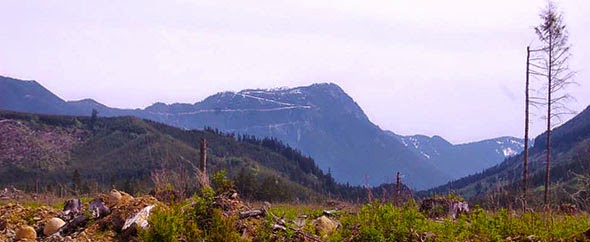
| The Group at Harrison Lake |
Harrison Grind - April 19th, 2014 Harrison Hot Springs, British Columbia
Kilometers: 6.9k round trip
Elevation Gain: 620m
Dogs Allowed
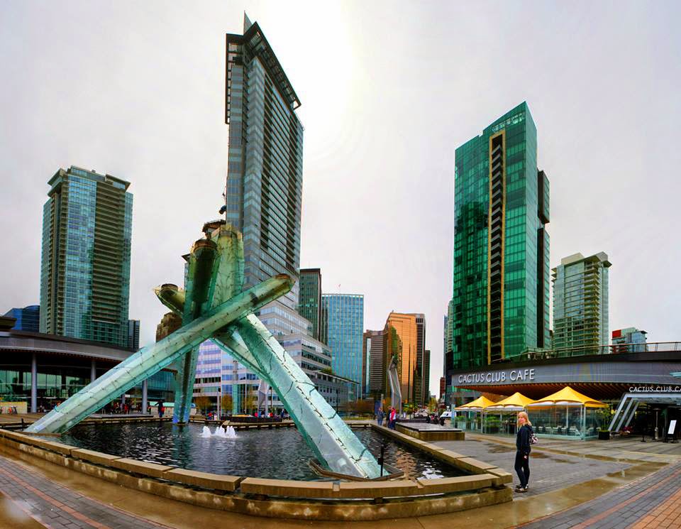 |
| Allison at the 2010 Olympic Torch in Vancouver |
Harrison Hot Springs is a small resort community located on a beautiful lake that is surrounded by mountains on all sides and kind of looks like a fjord. Allison and I were really excited to discover that we could walk from our condo right to the trailhead of an awesome mountain hike. On Saturday morning Allison and I put together our hiking gear and headed out to the mountain as the rest of our group went off to the spa.
Allison: There was actually a bit of disagreement here between us and our group, we were really pushing for our friends to come hiking with us (in hindsight it was good that they didn't, spoiler!). Jesse said “I can hike anywhere, I want to go to a spa.”
Wait. WUT.
 You can hike anywhere but you want to go sit inside while some faceless person rubs on you? I mean I can see the appeal, but you can, in fact, literally do that ANYWHERE, whereas you can hike many places, but not a single one will be the same. However, I digress, back to Chris...
The Harrison Grind’s name is a spin off of the name of one of the most popular hikes in Vancouver called the Grouse Grind, and while the Harrison Grind trail is not quite the torture test that the Grouse Grind is, it still offered us with a challenging (especially hung over) and rewarding hike.
We left our condo and took a short half-mile walk to the trailhead. The first half-mile of the hike was very steep and took us up a gravel service road to Harrison’s water tower.
From the water tower the path continued up a trail that followed a power line through a boulder field.

It also began raining, which wasn’t really a big surprise being that we were still in the Pacific Northwest, we donned our rain gear and pushed on.
Allison: I had however forgot to pack my hiking boots, so my feet were suuuuper squishy about 20 minutes into the hike. But, Goonies never say die!
 |
| Can you see the T-Rex? |
Now, there are rules of etiquette, whether spoken or not, that govern just about every social situation. This includes hiking. For instance, when you are in a hiking group that is headed back down from a summit with a difficult and/or grueling ascent, it is common courtesy when encountering another group who is struggling on their way up the same summit to lie to them about one or more of the facts surrounding the rest of their journey to the top. In the United States the conversations usually go something like this:
Scenario #1
Other Group: How much further do you think it is to the top?
Your Group: Probably about ¾ or a mile.
Reality: You are so happy to be coming down that you haven’t been paying
attention and have no idea. It could have been 5 miles… actually it probably was.
Scenario #2
Other Group: How much further do you think it is to the top
Your Group: You’re almost there! It’s just around the corner!!
Reality: You are completely sadistic, there are at least two more miles.
Scenario #3
Other Group: How much further do you think it is to the top?
Your Group: Still a few more miles.
Reality: You want them to be pleasantly surprised when the summit is just around
the corner. This is the most unlikely of the three scenarios.
 As a ‘Murican, upon your first visit to Canada you will quickly realize that Canadians are, well, very stereotypically Canadian. You will quickly learn that the word sooorry is much more versatile than you once imagined. You will be told sooorry for any reason imaginable: A waitress, for instance might be sooorry for taking your order, or someone passing you on the street might be sooory because they are passing you on the street. They are very friendly and very apologetic for no reason. About is pronounced aboot and Tim Horton’s, a popular doughnut chain, is one of the most important and talked about national treasures.
 About halfway up our hike we met an older Canadian gentleman on his way down the mountain and proceeded to stop and have a conversation which included all of the Canadian features mentioned above. He was also a strict observer of hiking etiquette. It went something like this.
Canadian Gentleman: Hello, eh, Soory did ya knooo aboot the Tim Horton’s they got at the top?
Chris & Allison: No, we didn’t
Canadian Gentleman: Ooh yaaa, well you fooolks enjoy your hike, eh.
Reality: There was no Tim Horton’s on the summit of the mountain, curse you Canadian gentleman for filling our thoughts with Honey Crullers!!!
 After another hour or two of hiking we reached the summit hoping to get an amazing view of the valley. While the view was still really beautiful, we couldn’t see many of the surrounding mountains because they were all covered in mist. Being that it was windy, wet and cold we snapped some pictures and did an about face and headed down the mountain. Overall the hike was quite steep and we ended up having to do some precarious scrambling over wet and slippery rocks and trees which were much more treacherous on the way down. Luckily we both came out of it unscathed. With good stories to tell our spa friends about the natural beauty of the
place we were visiting.